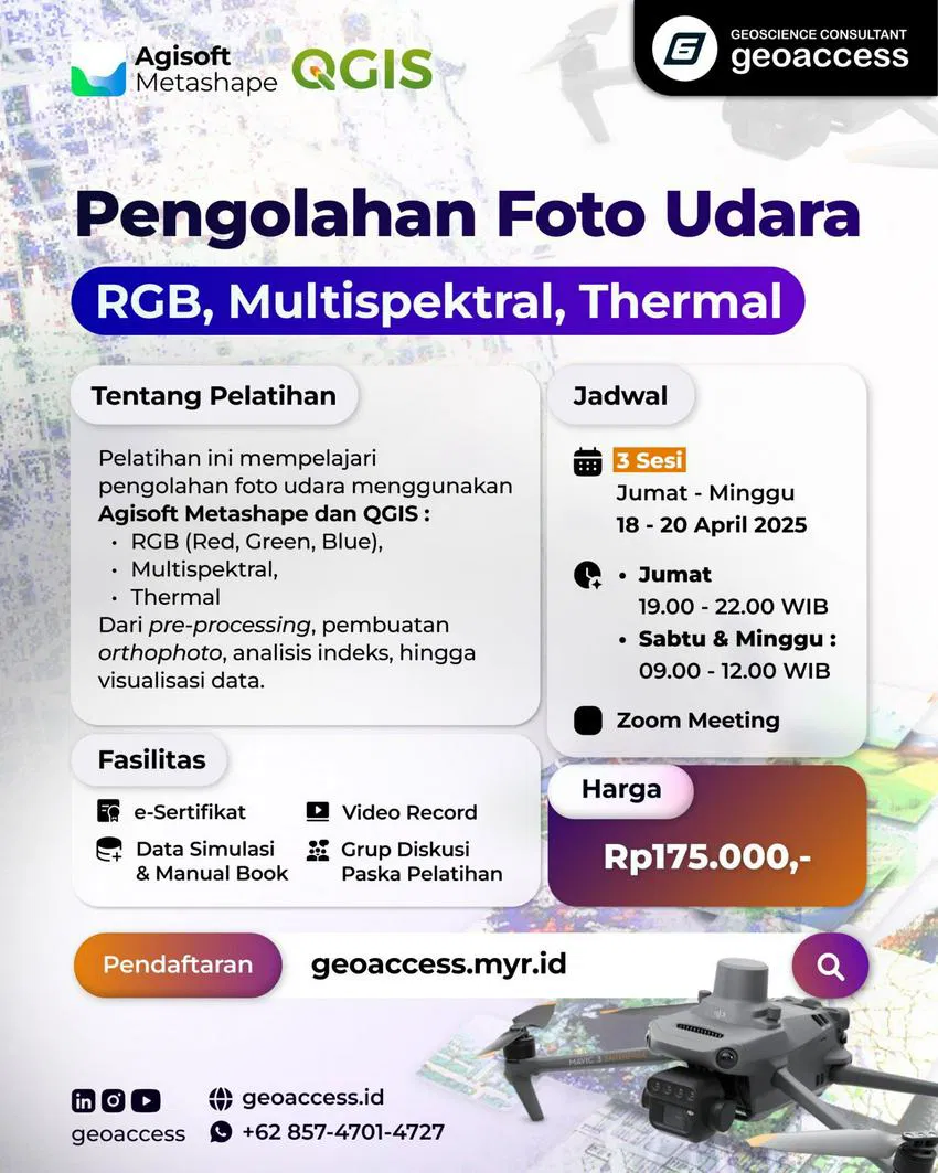
Pengolahan Foto Udara (Drone Mapping): RGB, Multispektral, Thermal
-
Rp175.000
-
9 Lesson
-
Deskripsi Kursus
Pelatihan Pengolahan Foto Udara (Drone Mapping): RGB, Multispektral, Thermal menggunakan Agisoft Metashape & QGIS
Training terdiri dari 3 sesi dengan durasi pembelajaran total 9 jam dan membahas materi antara lain:
Sesi 1
1. Pengantar Pemetaan Foto Udara
2. Pengenalan Interface Agisoft
3. Persiapan Data
4. Pengolahan Foto Udara RGB dengan GCP (Orthophoto dan DEM)
5. Ekspor Hasil
Sesi 2
1. Pengantar Foto Udara Multispektral
2. Pre-Processing Data
3. Pengolahan Foto Udara Multispektral (Orthophoto)
4. Pengenalan Interface QGIS
5. Vegetation, Water, Drought Indices
6. Simbolisasi
Sesi 3
1. Pengantar Foto Udara Thermal
2. Pre-Processing Data
3. Pengolahan Foto Udara Thermal (Orthophoto)
4. Temperature Indices
5. Simbolisasi
Materi Kursus
Persiapan Software
-
Agisoft Metashape Professional (Windows & MAC)
-
QGIS 3.28 LTR (Windows & MAC)
Materi dan Data Simulasi
Video Recording
Rating dan Ulasan Siswa
Keren, sangat informatif. mentor juga handal
Luar biasa
Terimakasih Geoaccess sukses selalu
cukup bagus
- Tag